Rockhounding Map Reading opens up a world of geological treasures for amateur collectors and experienced prospectors alike. Learning to interpret specialized geological maps transforms random rock hunting into targeted expeditions that yield valuable specimens and minerals.
These maps reveal the hidden geology beneath your feet, showing where volcanic activity once deposited gemstones or where ancient seas left behind fossil-rich limestone. Understanding map symbols, scales, and geological indicators helps you locate promising sites while avoiding restricted areas and dangerous terrain.
TL;DR
- USGS topographic maps use a 1:24,000 scale where 1 inch equals 2,000 feet in real distance.
- Fault lines on geological maps often indicate mineral-rich zones where hydrothermal fluids deposited crystals and ores.
- UTM coordinates provide accuracy within 1 meter for marking exact specimen locations.
- BLM and Forest Service lands allow casual collecting up to 25 pounds per day without permits in most areas.
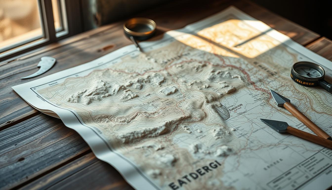
Rockhounding Map Reading Fundamentals
Reading rockhounding maps starts with understanding three core elements that determine your success in the field. Map scales tell you the level of detail available, while coordinate systems help you navigate to specific locations with precision.
The legend serves as your decoder ring for geological symbols and color schemes. Different colors represent rock formations of various ages, and specialized symbols mark features like mineral deposits, fault lines, and known collecting areas.
Map Scale Interpretation
Scale ratios determine how much real-world distance each map unit represents. A 1:24,000 scale means one inch on the map equals 24,000 inches (2,000 feet) on the ground, providing detailed terrain features perfect for rockhounding.
Larger scale numbers like 1:100,000 cover more area but show less detail. Use detailed scales for specific site exploration and broader scales for regional planning and route selection.
Coordinate Systems for Precision
GPS coordinates use two main systems for location marking. Latitude and longitude provide global positioning using degrees, minutes, and seconds, while UTM coordinates offer metric-based grid references that simplify distance calculations.
Modern GPS devices display both systems, but UTM coordinates work better for measuring distances between collecting sites. Each UTM zone covers 6 degrees of longitude and uses meters for all measurements.
Types of Geological Maps
Different map types serve specific purposes in rockhounding, from identifying rock formations to avoiding legal complications. Understanding which maps to use for different situations saves time and prevents costly mistakes.
USGS Topographic Maps
United States Geological Survey maps provide the foundation for most rockhounding expeditions. These quadrangle maps cover standard 7.5-minute areas and include both topographic features and basic geological information.
Contour lines show elevation changes that reveal geological structures like anticlines and synclines where minerals often concentrate. Stream patterns and ridge formations visible on topo maps indicate erosion patterns that expose valuable specimens.
State Geological Survey Maps
State surveys produce specialized maps focusing on local geology and known mineral occurrences. These maps often include mine locations, quarries, and documented collecting areas not found on federal maps.
Color-coded geological formations show rock ages and types, helping you target specific minerals associated with particular formations. Many state maps include cross-sections that reveal subsurface geology.
Mining Claim Maps
Bureau of Land Management mining claim maps show active and historical claims on public lands. These maps prevent accidental trespassing on claimed areas where collecting requires permission from claim holders.
Claim boundaries appear as numbered sections with contact information for claim owners. Some claims allow recreational collecting with permission, while others restrict all access for commercial operations.
Check Claim Status Before Collecting
Mining claims change ownership frequently, so verify current status through BLM records. Abandoned claims revert to public access after proper documentation.
Reading Geological Features
Geological features on maps reveal where specific minerals formed millions of years ago. Learning to recognize these patterns helps you predict what specimens you might find in different rock formations, similar to the field identification techniques used when examining actual specimens.
Rock Formation Identification
Map colors and patterns represent different rock types and ages using standardized symbols. Igneous rocks appear in various colors depending on their composition, with granite formations often shown in pink or red patterns.
Sedimentary rocks display in layers with different patterns for limestone, sandstone, and shale formations. Metamorphic rocks use distinct symbols to show areas where heat and pressure transformed original rock types.
- Igneous formations – indicate areas with quartz crystals, feldspar, and volcanic glass
- Sedimentary layers – contain fossils, geodes, and layered agates
- Metamorphic zones – host garnets, mica crystals, and contact minerals
- Fault systems – mark locations where mineralized solutions deposited valuable specimens
Mineral Deposit Indicators
Certain geological features consistently associate with specific mineral types. Pegmatite dikes, shown as narrow intrusive bodies on geological maps, often contain large crystals of quartz, feldspar, and rare minerals like beryl and tourmaline.
Hydrothermal alteration zones appear as irregular colored areas around igneous intrusions. These zones frequently contain chalcedony, jasper, and metal-bearing minerals deposited by hot groundwater.
Navigation Tools and Techniques
Successful map reading requires reliable tools for measuring distances, determining directions, and recording locations. Combining traditional tools with modern technology provides backup systems when electronics fail, which is why experienced collectors rely on a comprehensive field equipment checklist.
Essential Field Equipment
A quality compass provides direction finding independent of batteries or satellite signals. Choose a compass with degree markings and adjustable declination to account for the difference between magnetic north and true north in your area.
GPS devices offer precise location marking but require backup power and clear satellite reception. Modern smartphones with offline map apps provide convenient navigation when cell towers are available.
- Orient your map. Align the map with landscape features using a compass bearing to establish your position relative to visible landmarks.
- Identify key features. Locate prominent ridges, valleys, and water features on both map and terrain to confirm your position.
- Mark your route. Plot waypoints for parking areas, trail junctions, and collecting sites to ensure safe return navigation.
- Record discoveries. Document GPS coordinates and geological details for successful locations to share with other collectors.
Digital Mapping Resources
Modern mapping apps provide layered geological information unavailable on traditional paper maps. Applications like Rockd combine geological surveys with user-contributed collecting reports and photographs.
Offline mapping software allows downloading detailed maps before entering areas without cell coverage. These apps often include geological overlays, property boundaries, and trail information in single packages.
Legal and Safety Considerations
Understanding land ownership and collecting regulations prevents legal troubles and ensures continued access to collecting areas. Maps clearly show boundaries between different land management agencies with varying rules, making proper site research essential before any expedition.
Public Land Access
Bureau of Land Management and Forest Service lands generally allow casual mineral collecting for personal use. Most areas permit collecting up to 25 pounds of common rocks and minerals per day without special permits.
National parks prohibit all collecting activities, while state parks vary by location and mineral type. Always check specific regulations before collecting in any managed area.
Private Property Recognition
Survey lines on detailed maps show property boundaries between public and private lands. Look for section lines, township boundaries, and ownership annotations to avoid trespassing.
Private land requires landowner permission for access and collecting. Some property owners charge fees or require liability waivers for rockhounding activities on their land.
Environmental Protection
Sensitive ecological areas and cultural sites appear on modern maps with restriction symbols. These areas prohibit collecting to protect archaeological resources, endangered species habitat, or fragile ecosystems.
Wilderness areas limit group sizes and restrict motorized access while still allowing hand tool collecting in most cases. Always follow safety guidelines and check current regulations as wilderness rules change periodically.
Frequently Asked Questions
How accurate are GPS coordinates for marking rockhounding sites?
Modern GPS devices provide accuracy within 3-5 meters under normal conditions. UTM coordinates work better than latitude/longitude for sharing precise locations with other collectors.
What map scale works best for detailed rockhounding?
1:24,000 scale topographic maps provide optimal detail for rockhounding, showing individual ridges, draws, and terrain features. Larger scales lack sufficient detail for precise navigation.
Can I collect minerals on active mining claims?
Active mining claims require permission from claim holders before collecting any materials. Contact information appears on BLM mining claim maps or through online claim databases.
How do geological colors on maps indicate mineral potential?
Different colors represent rock formations of various ages and compositions. Pink areas often show granite with quartz and feldspar, while green areas may indicate mineral-rich metamorphic rocks.
What digital apps work best for offline rockhounding maps?
Apps like Gaia GPS, AllTrails, and Rockd provide downloadable maps with geological overlays. Always download maps before entering remote areas with limited cell coverage.
Final Thoughts
Rockhounding Map Reading skills transform casual rock hunting into productive expeditions that consistently yield valuable specimens and memorable discoveries. Understanding geological features, navigation techniques, and legal boundaries opens access to countless collecting opportunities across public lands.
Start with simple topographic maps in your local area and gradually add geological overlays as your skills develop. Practice reading contour lines and identifying rock formations before venturing into remote locations where navigation mistakes become dangerous, and consider exploring accessible coastal sites to apply your new mapping skills in safer environments.